Famous cycling climbs in France: the 21 hairpins to Huez, Mont Ventoux and the Tourmalet
France’s three most famous cycling climbs, on the sides that made them famous: the 21 hairpins from Bourg-d’Oisans, Mont Ventoux from Bédoin and the Col du Tourmalet from Luz-Saint-Sauveur. Lengths, gradients and practical notes from the local tourist offices, then two great climbs beyond France.
, 7 min read
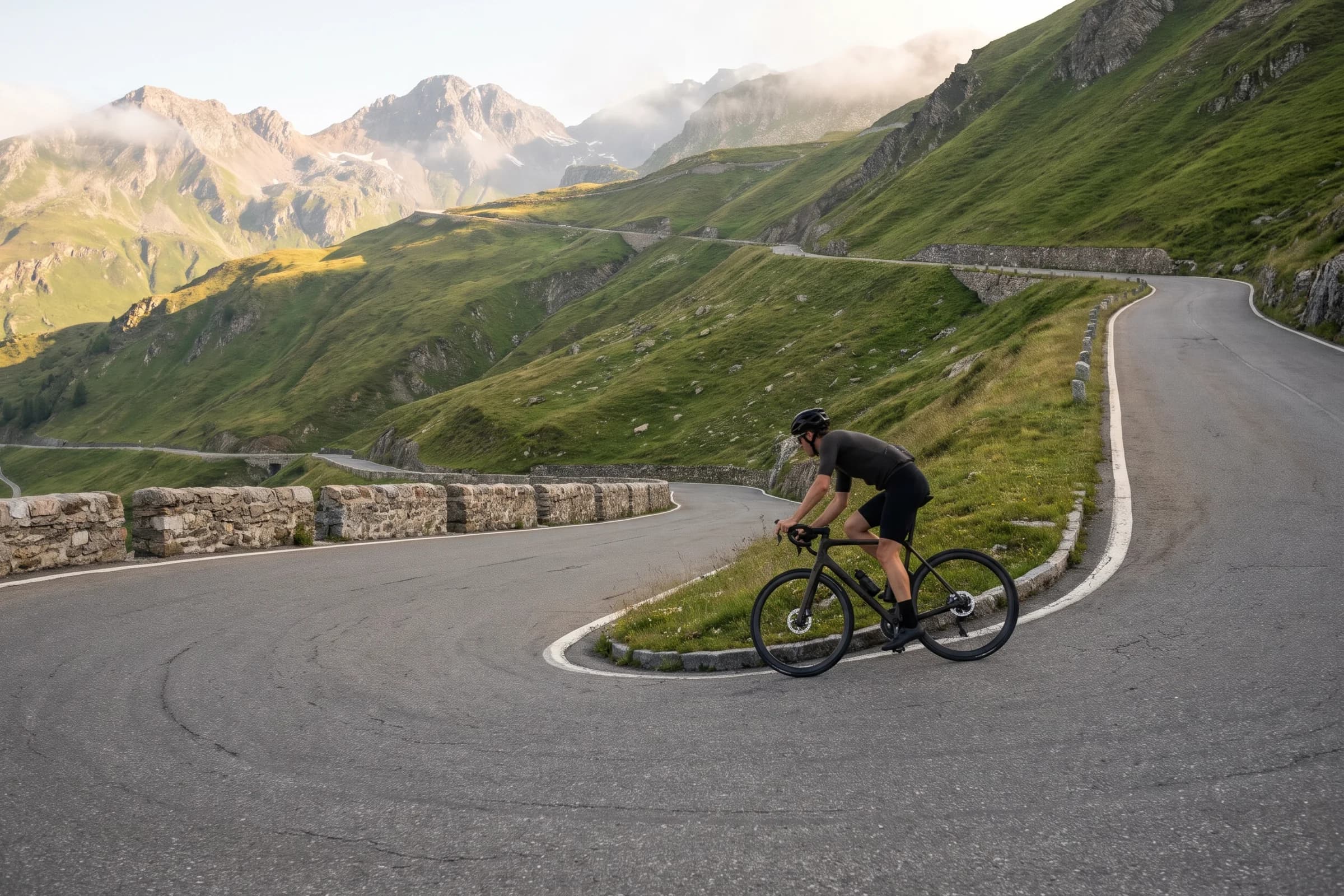
France has no shortage of famous climbs, but three are on almost every rider’s list: Alpe d’Huez from Bourg-d’Oisans, Mont Ventoux from Bédoin and the Col du Tourmalet from Luz-Saint-Sauveur. Each is between 14 and 22 km long, climbs well over 1,000 m and averages around 7 to 8 per cent, with steeper ramps along the way. Below are the official figures for each, taken from the local tourist offices and the resort itself, with the practical details you need before you ride them.
After France we cross into Italy for the 48 hairpins of the Stelvio from Prad, and into Romania for the Transfăgărășan.
The three at a glance
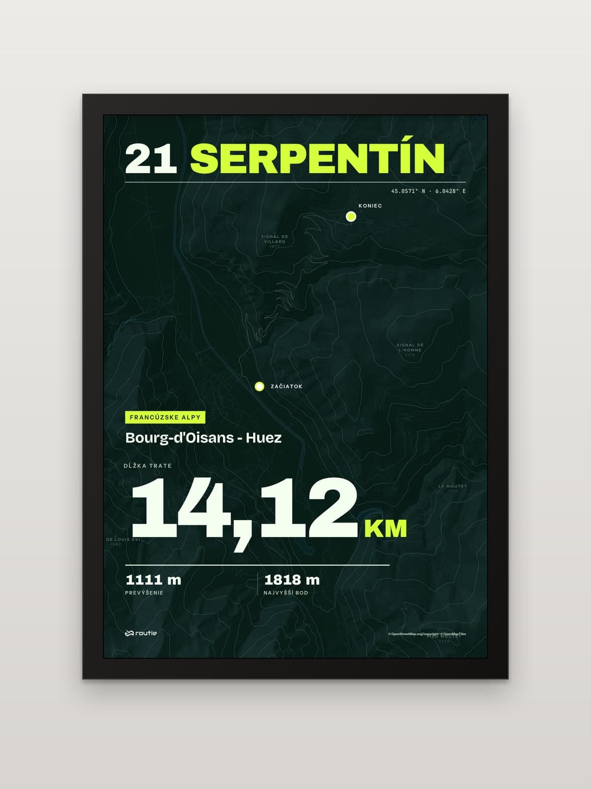
The 21 hairpins from Bourg-d’Oisans: 14.454 km (about 9 miles), 1,121 m of ascent, 7.9 per cent average, 21 hairpins.
Mont Ventoux from Bédoin: 22 km (about 13.7 miles) to a 1,910 m summit, with an 8 km middle section at 9.4 per cent.
Col du Tourmalet from Luz-Saint-Sauveur: 19 km (about 11.8 miles) at 7.39 per cent to 2,115 m.
The 21 hairpins from Bourg-d’Oisans
The climb in numbers
The resort’s official figures: from Bourg-d’Oisans at 717 m to the resort at 1,860 m, 14.454 km with 1,121 m of ascent, an average gradient of 7.9 per cent and a maximum of 14 per cent. The neighbouring Oz-en-Oisans tourist office rounds it to 14 km and 1,120 m. The record listed by the resort is Marco Pantani’s 37 minutes 35 seconds, set in 1997.
Hairpin by hairpin
The 21 hairpins are numbered backwards: bend 21 is at the bottom, at about 806 m, and the numbers count down as you climb, through bend 17 at 965 m, bend 15 at 1,025 m and bend 12 at 1,161 m, to bend 1 at 1,713 m. After the last hairpin there is still the final run into the resort. Each stage winner at the top has their name associated with one of the bends, according to the Oz-en-Oisans tourist office.
The official timed section starts opposite the EDF gate, about 300 m after you leave the main road at Bourg-d’Oisans, and finishes at the top of the Avenue du Rif-Nel after the last roundabout. The resort issues ‘Alpe climb’ certificates from May to September, and notes that in cold, dry weather the climb can often be ridden in April and December too. Check the resort’s 21 bends page for current information.
The line on our print runs from Bourg-d’Oisans through all 21 hairpins: 14.12 km and 1,111 m of climbing. The small difference from the official 14.454 km comes from exactly where you start and stop.
Mont Ventoux from Bédoin
Why Bédoin
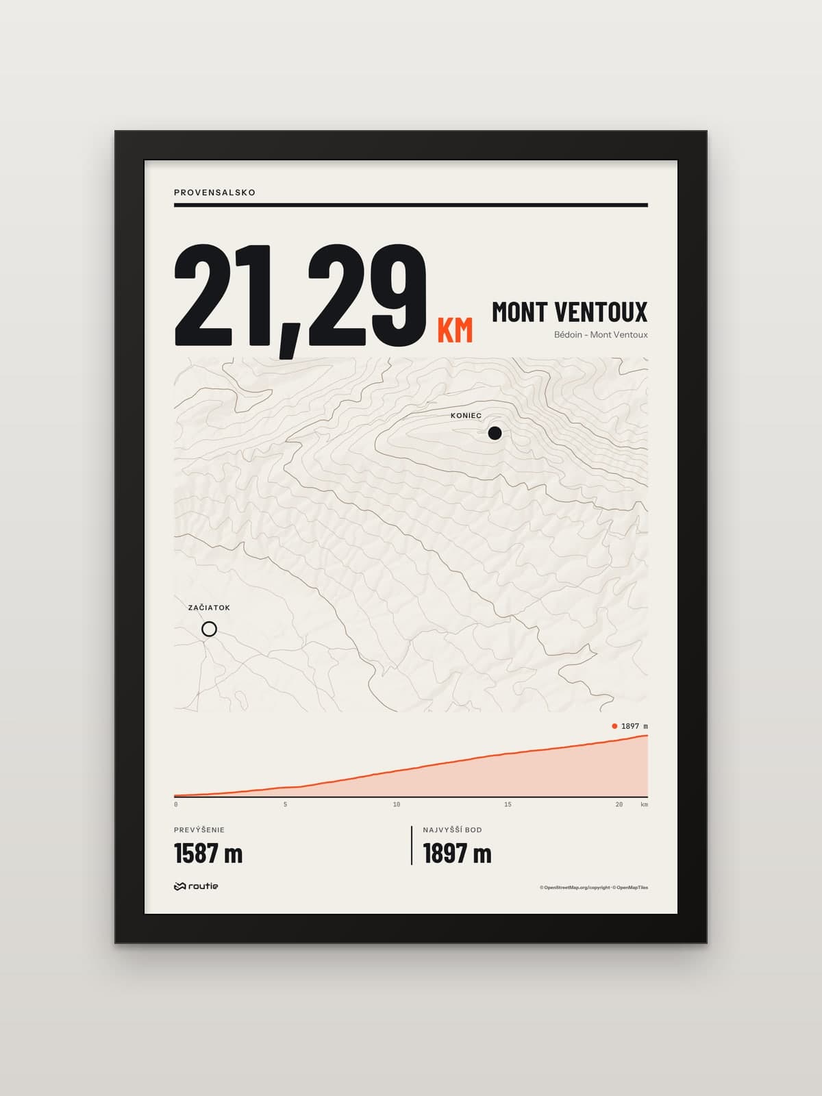
Mont Ventoux, the ‘Giant of Provence’, tops out at 1,910 m and has been a UNESCO Biosphere Reserve since 1990. According to the regional tourist board, most riders start from the village of Bédoin, and it is the side we print.
The three sections
The Vaucluse tourist board gives 22 km of winding road from Bédoin and splits the climb into three:
Bédoin to Saint-Estève: 5.5 km at about 4.5 per cent, a warm-up.
Saint-Estève to Chalet Reynard: 8 km at 9.4 per cent, probably the hardest part.
Chalet Reynard to the summit: 6 km at 8 per cent, where the lunar landscape of the massif opens up and the exposure to sun and wind makes the last stretch particularly hard.
Practical notes
The road over the top is closed from 15 November to 15 April each year, though Chalet Reynard can be reached all year. Winds near the summit can be very strong. In summer, avoid the hottest hours and set off early in the morning or late in the day. Water is available at fountains outside the Bédoin tourist office, at Chalet Reynard and at La Grave, 1.6 km beyond it. The line on our print measures 21.29 km with 1,587 m of climbing.
Col du Tourmalet from Luz-Saint-Sauveur
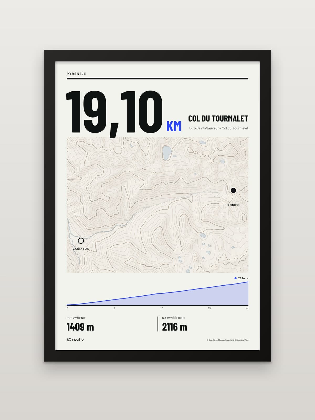
The Vallées de Gavarnie tourist office calls the Col du Tourmalet (2,115 m) the most famous pass in the Pyrenees. From Luz-Saint-Sauveur the climb is 19 km at an average gradient of 7.39 per cent, and the great stage races first crossed it in 1910. The line on our print runs 19.10 km from Luz-Saint-Sauveur to the col, with 1,409 m of climbing.
Beyond France: the pass above Prad and the Transfăgărășan
The pass above Prad: 48 hairpins
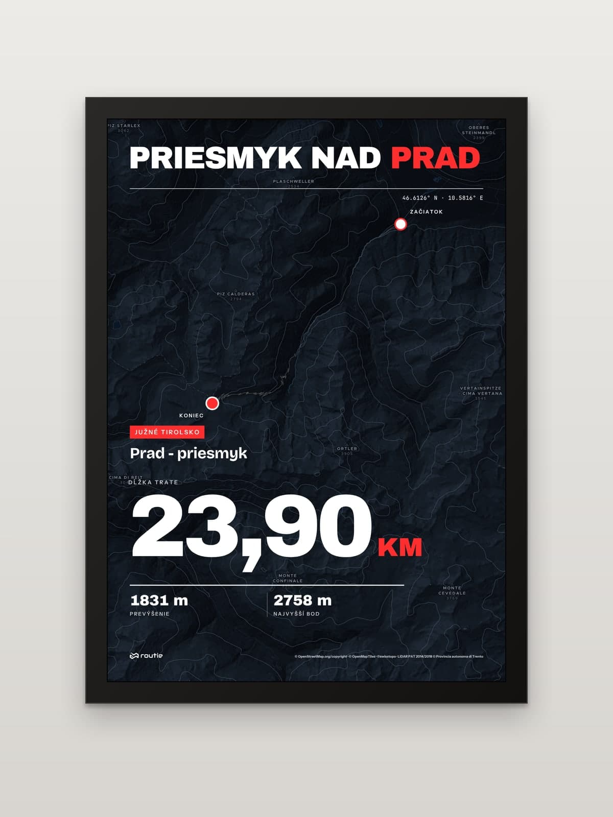
Our print ‘The pass above Prad’ shows the north ramp of the Stelvio Pass (Passo dello Stelvio, Stilfser Joch in German) from Prad in South Tyrol. We checked the print’s own line: it starts in Prad and ends at the pass, at 2,758 m on our elevation data, after 23.90 km and 1,831 m of climbing.
South Tyrol’s tourist board gives the climb from Prad as 25 km and 1,838 m of ascent through Gomagoi, Trafoi and Franzenshöhe, with a total of 48 hairpins, and describes the Stelvio as the second-highest paved mountain pass in Europe. The Vinschgau valley rates the ride as difficult. At the end of August the road is closed to motor traffic for a whole day for the Stelvio Bike Day, when it belongs to cyclists.
The Transfăgărășan from Cârțișoara
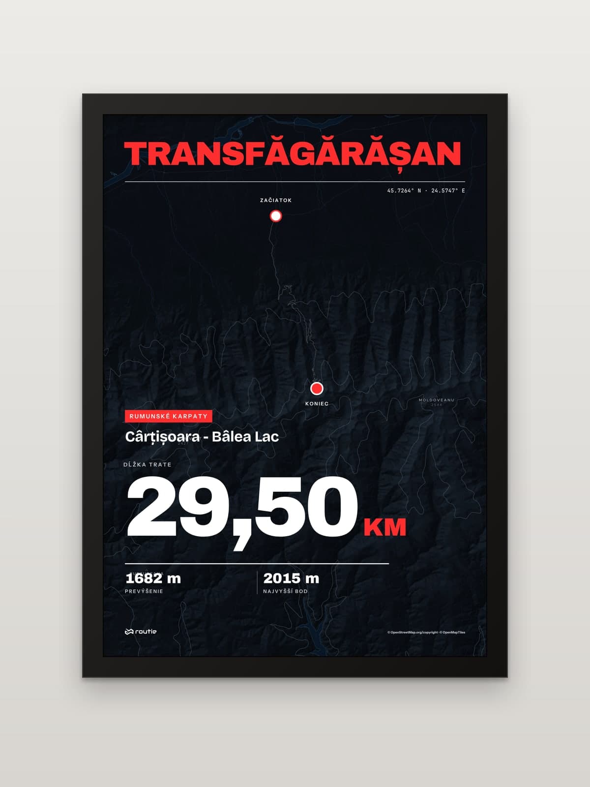
The Transfăgărășan, road DN7C, crosses the Romanian Carpathians. Our print shows its north ramp from Cârțișoara to the glacial lake at Bâlea: 29.50 km and 1,682 m of climbing, topping out at about 2,015 m by the lake. The high section is a summer road. According to the dispatch service of CNAIR, Romania’s national road company, the stretch between Piscu Negru and Bâlea Cascadă opened on 12 June 2026, is closed every night from 21:00 to 07:00 and is closed to traffic in winter. Check the CNAIR road dispatch page before you travel.
A climb on the wall
Climbs are where our prints differ most from a flat map. We 3D-print the route in matte PLA and glue it onto the glass exactly above the route on the map. Its height follows the terrain, 4 mm at the lowest point and 15 mm at the highest by default, and the higher stretches stand proud of the frame, so the top of the climb really is the highest part of the print. Each print comes in A5, A4 or A3 with a black or white frame, and every print is made to order.
If you have ridden a climb that is not on this list, you can have that too: upload the ride as a GPX, TCX or KML file and design a print of your own route. Our guide on how to export a GPX from Strava explains how to get the file, and if you are shopping for someone who collects climbs, see our gifts for cyclists.
Frequently asked questions
How hard is it to climb Mont Ventoux?
From Bédoin it is 22 km to a 1,910 m summit. The first 5.5 km average about 4.5 per cent, but the 8 km from Saint-Estève to Chalet Reynard average 9.4 per cent, and the final 6 km at 8 per cent are exposed to sun and wind. Heat in summer and strong winds near the top make it harder than the numbers suggest.
How many hairpins are on the climb to Huez?
Twenty-one. They are numbered from 21 at the bottom in Bourg-d’Oisans to 1 at the top, so the numbers count down as you climb. Bend 1 is at 1,713 m, according to the resort.
How many hairpins are there on the climb from Prad?
Forty-eight on the climb from Prad, according to South Tyrol’s tourist board, over 25 km and 1,838 m of ascent through Gomagoi, Trafoi and Franzenshöhe.