Dolomites Alta Via 1: stages, huts and the Tre Cime loop
The Alta Via 1 crosses the Dolomites from Lago di Braies to Belluno, hut to hut, in 11 or 12 stages. Here is every stage, how hard the route is, when the huts open and how bookings work, plus the Tre Cime loop as a day hike and Triglav as the Julian Alps alternative.
, 8 min read
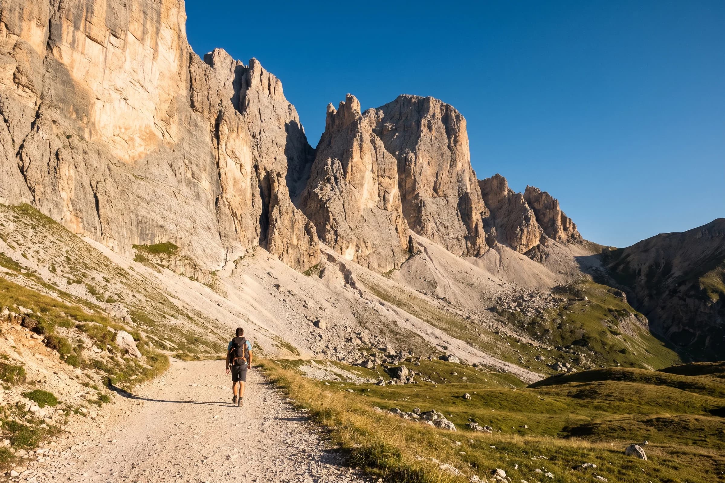
The Alta Via 1 is a hut-to-hut trek across the Dolomites from Lago di Braies in the north to Belluno in the south. The Italian Alpine Club (CAI) gives it as about 125 km with 7,300 m of ascent; the guidebook publisher Cicerone gives 115 km in 11 stages, finishing at La Pissa near Belluno. The difference is where you stop and which variants you take. Cicerone allows approximately two weeks; you sleep in rifugi every night, and the season runs from mid-June to late September.
This guide goes through the route stage by stage, covers the difficulty, the season and hut bookings, compares it with the Alta Via 2, and ends with two shorter objectives: the loop around the Tre Cime di Lavaredo as a day hike, and Triglav in the Julian Alps.
Alta Via 1 at a glance
Start: Lago di Braies, reached by bus.
Finish: Belluno, or La Pissa just outside it, with a 20-minute bus into town and trains towards Venice.
Distance: about 115 km (Cicerone) to 125 km (CAI). The line on our print measures 117.96 km.
Ascent: about 7,300 m by CAI’s figure. Our line has 7,872 m.
Stages: 11 (Cicerone) or 12 (the Cortina d’Ampezzo tourist board).
Season: mid-June to late September.
Grade: Cicerone grade 2 overall, with harder grade 3 variants.
Alta Via 1 stages
The Cortina d’Ampezzo tourist board lists the route in 12 stages, each 6 to 15 km and 3 to 6 hours of walking. This is the breakdown, with the huts where each day ends.
Lago di Braies to Rifugio Biella. A short first day, 6 km, to the hut below the Croda del Becco.
Rifugio Biella to Rifugio Fanes. 14 km.
Rifugio Fanes to Rifugio Lagazuoi. 11 km, the day you climb to the Lagazuoi.
Rifugio Lagazuoi to Rifugio Nuvolau. 15 km, the longest stage on this breakdown.
Rifugio Nuvolau to Rifugio Croda da Lago. 11 km.
Rifugio Croda da Lago to Rifugio Venezia and Palafavèra. 12 km.
Palafavèra to Rifugio Vazzoler by Rifugio Coldai and Rifugio Tissi, 14 km and about 6 hours, one of the two longest walking days.
Rifugio Vazzoler to Rifugio Carestiato. 8 km.
Rifugio Carestiato to Rifugio Sommariva al Pramperét. 13 km.
Rifugio Sommariva to Rifugio Pian de Fontana. 6 km.
Rifugio Pian de Fontana to Rifugio 7° Alpini. 7.5 km.
Rifugio 7° Alpini to Belluno by Case Bortot, 12 km down to the valley.
The CAI booking site splits the same line into 12 stages too, with slightly different overnights in the middle (Cinque Torri and the Staulanza pass, for example), which shows how freely the days can be rearranged.
How hard is the Alta Via 1?
Of the Dolomites’ high routes, Cicerone rates the Alta Via 1 as the easiest, grade 2 overall. CAI describes the basic route as running on paths that are not particularly challenging for a good hiker, with the most difficult sections equipped. The harder options are variants: Cicerone grades the Lagazuoi tunnels and the Pelmo circuit as grade 3, and one stage includes short cable-aided stretches that a variant avoids. The Cortina tourist board labels every stage as being for experts, which is a fair reminder that this is still high mountain terrain with long days.
Season and hut bookings
The season runs from mid-June to late September. Huts in the northern, South Tyrolean part can stay open into October, while those in the southern Dolomites may close in late September. Cicerone strongly recommends reserving, especially in July and August, when organised groups fill huts well in advance, and a deposit is often required. CAI’s booking platform has its own Alta Via 1 page with the stages and booking contacts.
Alta Via 1 or Alta Via 2?
The Alta Via 2 runs from Bressanone to Feltre, about 174 km in 13 stages according to Cicerone, which rates it grade 2 to 3 overall, more demanding than the Alta Via 1. Its aided sections are not full via ferratas, and Cicerone says a full harness and helmet are not required. It calls the Alta Via 2 the natural progression for trekkers who have already completed the Alta Via 1. If this is your first hut-to-hut trek in the Dolomites, start with the Alta Via 1.
The Tre Cime di Lavaredo loop: the day hike
If you have one day rather than two weeks, the loop around the Tre Cime di Lavaredo is the classic. According to the municipality of Auronzo di Cadore it is about 9 to 10 km, takes 3 to 4 hours and climbs roughly 400 m, a loop it describes as suitable even for less experienced walkers. It starts at Rifugio Auronzo (2,333 m), passes Rifugio Lavaredo (2,344 m) and tops out at the Forcella Lavaredo (2,454 m) before circling the north side of the three peaks. The line on our print measures 9.10 km with 407 m of ascent and goes over the Forcella Lavaredo and the Forcella Col di Mezzo.
Getting there needs planning. A toll road of about 6 km runs from Misurina to Rifugio Auronzo, usually open from late May to October depending on snow, and parking at the Tre Cime is by reservation only. Without a car, Dolomitibus runs from Auronzo and Cortina, and the 444 shuttle from Dobbiaco runs from mid-June to the end of September, also by reservation.
Triglav: the Julian Alps alternative
Slovenia’s highest peak, Triglav (2,864 m), is a different kind of objective: one summit, a lot of height and an exposed finish. The Slovenian tourist board names the Pokljuka plateau, at about 1,300 m, as one of the easiest starting points, but still says to expect at least 6 to 8 hours of hiking each way and recommends splitting it over two days. The usual overnight is Kredarica, Slovenia’s highest mountain hut. The last section from Kredarica is steep and exposed, with fixed cables, and the tourist board advises a helmet, a self-belay kit and a harness, or a licensed mountain guide if you lack experience. Huts in the high mountains are typically open from May to October. Our line runs from Rudno polje by Kredarica to the summit: 12.80 km and 1,761 m of ascent.
The routes as prints
All three lines are ready-made prints. We 3D-print the route in matte PLA and glue it onto the glass exactly above the route on the map. Its height follows the terrain, 4 mm at the lowest point and 15 mm at the highest by default, so on the Alta Via 1 you see the whole rhythm of passes and valleys across two weeks, and on the Tre Cime loop the climb to the Forcella Lavaredo.
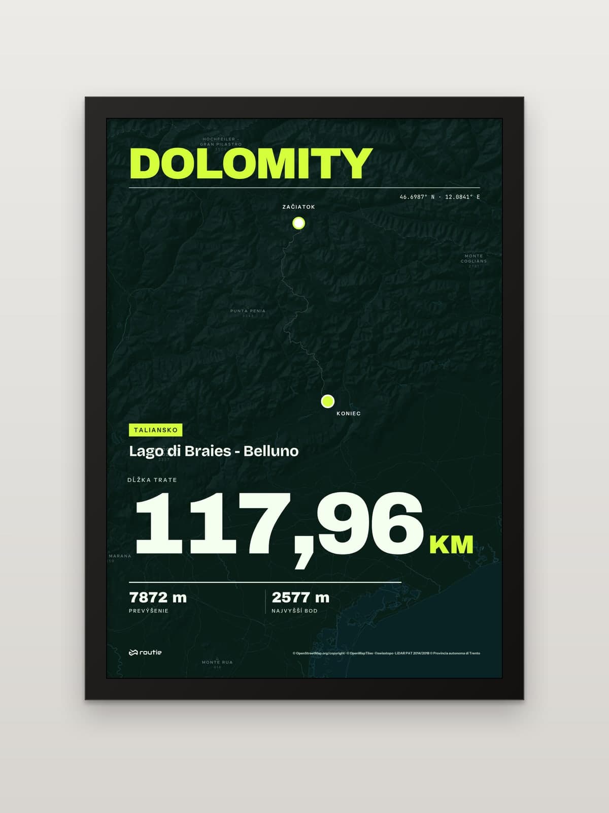 View Dolomites: Lago di Braies to Bellunofrom €35.00
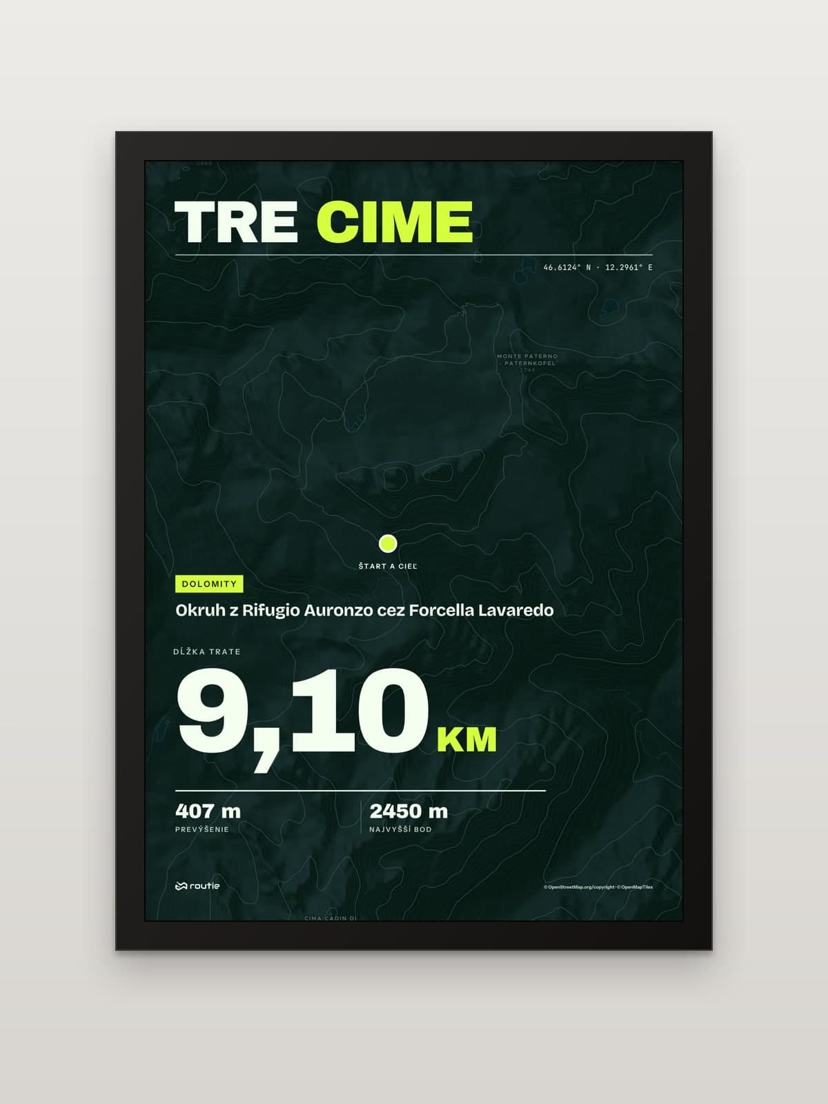 View Loop around the Tre Cimefrom €35.00
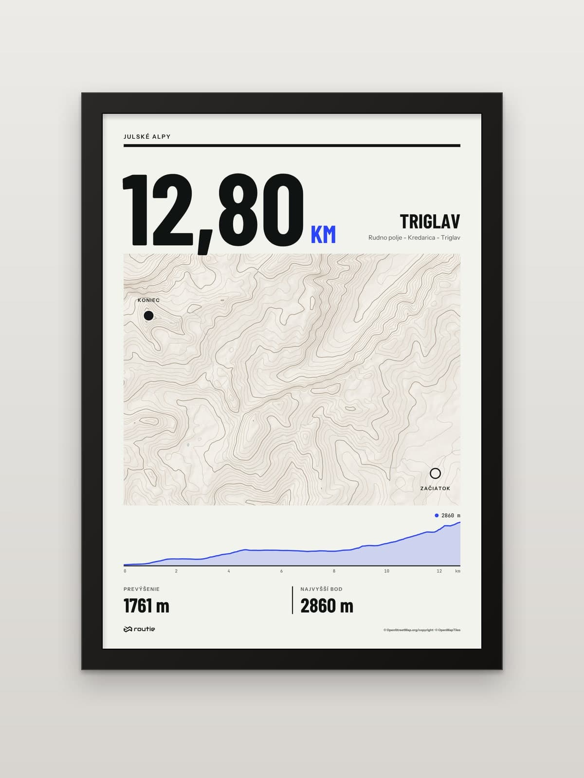 View Triglav from Pokljukafrom €35.00
Each print comes in A5, A4 or A3 with a black or white frame, and every print is made to order. If you walked the Alta Via 2, a variant or your own link-up between huts, upload the recording as a GPX, TCX or KML file and design a print of your own route.
For another classic hut-to-hut loop, through three countries this time, see our guide to the Mont Blanc loop trek. And if you are planning a trip further east, our pick of the best hikes in Slovakia covers the High Tatras, the Low Tatras and Slovak Paradise.
Frequently asked questions
How long is the Alta Via 1?
About 115 km according to Cicerone and about 125 km with 7,300 m of ascent according to CAI, in 11 or 12 stages. Cicerone allows approximately two weeks. The line on our print measures 117.96 km.
Alta Via 1 or Alta Via 2?
Start with the Alta Via 1. Cicerone rates it grade 2 and the Alta Via 2 grade 2 to 3, longer at about 174 km and more demanding, and describes the Alta Via 2 as the natural next step after the first.
How do hut bookings work on the Alta Via 1?
You book each rifugio for each night. Reservations are strongly recommended, especially in July and August, and a deposit is often required. CAI’s booking platform lists the route’s stages and contacts.
Can you hike Triglav in one day?
The Slovenian tourist board counts at least 6 to 8 hours of hiking each way from Pokljuka and recommends splitting the hike over two days, usually with a night at Kredarica. Done in one day, that estimate adds up to 12 hours or more on your feet, plus the cabled final section, which is why its advice is two days.