Rysy hike: Slovakia or Poland, time, difficulty and elevation gain
Rysy is where Poland reaches its highest point, yet one of the two ways up starts in Slovakia. Here is the route from Štrbské Pleso leg by leg, how hard it really is, when the trail is open, and how it compares with the climb from Morskie Oko.
, 9 min read
The Rysy hike from Štrbské Pleso in Slovakia is a demanding full-day mountain walk: about 4½ hours up, 8½ hours for the whole loop, with 1,250 m of ascent according to Slovakia’s official tourism portal. The one technical section is a rock step below the Chata pod Rysmi hut, protected by fixed chains. On the Slovak side the summit trail is open only from June to October; from 1 November to 31 May it is closed by the national park.
Rysy sits on the border, and its border summit (2,499 m) is the highest point in Poland. You can climb it from either country; from Slovakia the approach is longer but less steep. Below you will find the route, the timings, the difficulty and the Slovakia versus Poland question answered.
Rysy at a glance
Height: the highest summit of Rysy is 2,503 m, on the Slovak side; the border summit, 2,499 m, is Poland’s highest point.
Start: Štrbské Pleso (railway station, bus stop and car park).
Time: about 4½ hours up and 8½ hours for the full loop.
Elevation gain: 1,250 m by the official route description. The line on our print, from the station to the summit, is 10.05 km with 1,269 m of climb.
Difficulty: a demanding high-mountain hike, with chains on the rock step below Chata pod Rysmi.
Season: the red trail from the junction above Žabí potok to the summit is closed from 1 November to 31 May.
The route from Štrbské Pleso, leg by leg
The timings come from the route description on slovakia.travel. They are walking times, without breaks.
Štrbské Pleso to above Žabí potok (1¾ hours)
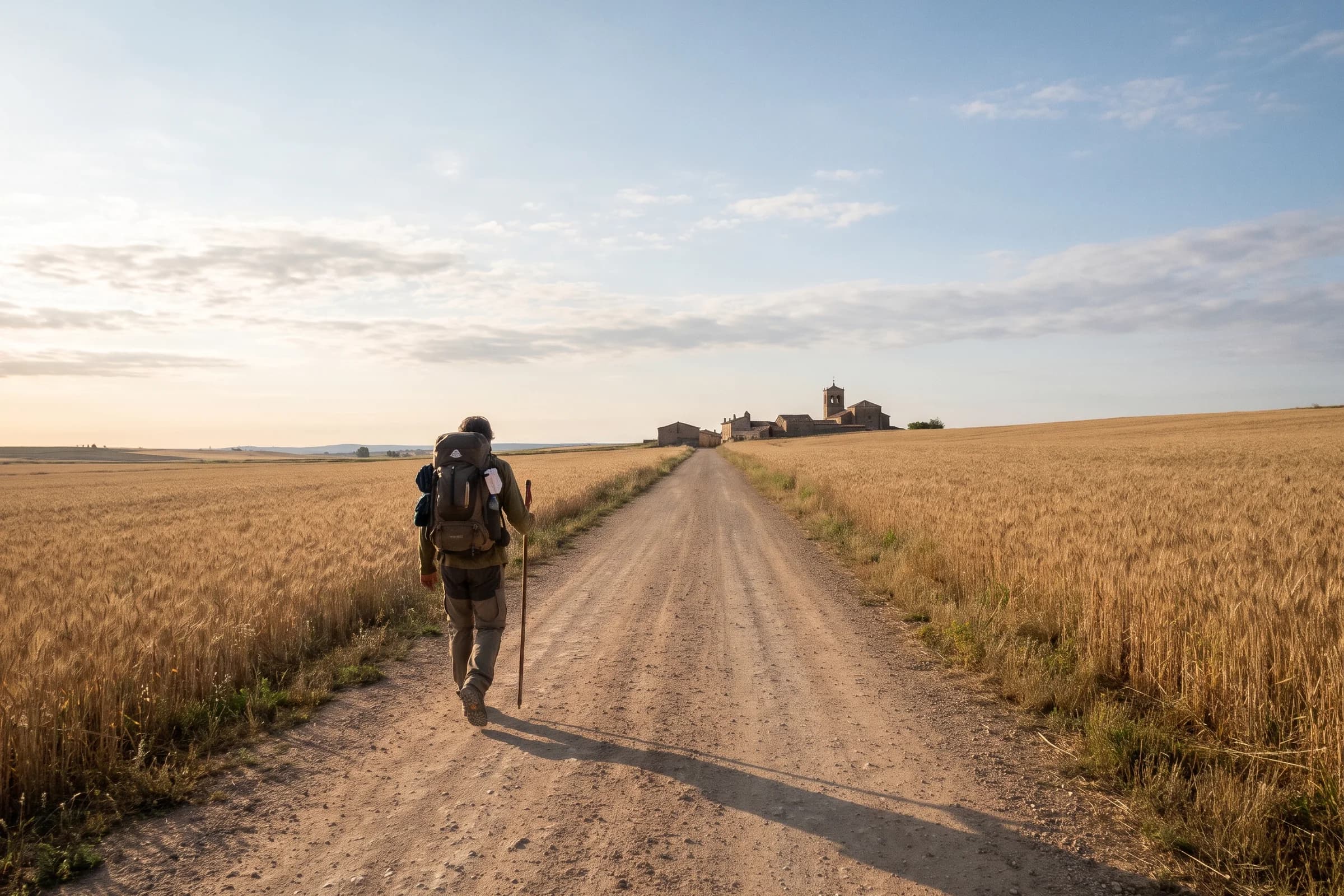
You leave Štrbské Pleso on marked trails towards Popradské pleso, a tarn you pass after roughly five kilometres on our line, and continue up the Mengusovská valley to the junction above the Žabí potok stream. This is the warm-up. Save your legs: the real work starts at the junction.
Above Žabí potok to Chata pod Rysmi (1¾ hours)
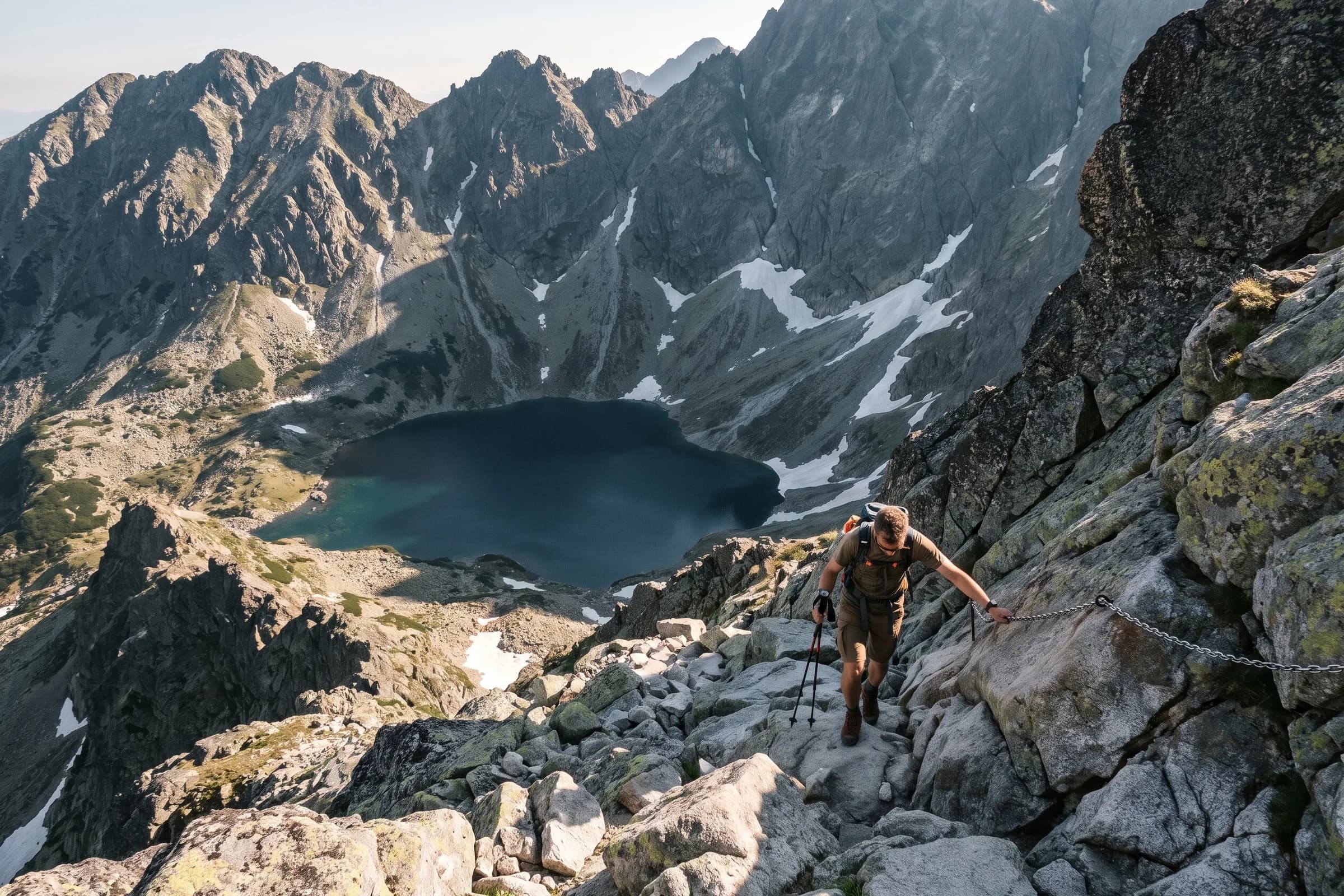
From the junction the red trail no. 0933 climbs past the Žabie plesá tarns to the hut, with switchbacks easing the steepest ground. Just below the hut comes the rock step, the hardest section of the day. It is secured with fixed chains and used in both directions, so expect to wait for people coming down.
Chata pod Rysmi stands at 2,250 m, and the Tatra information offices call it the highest situated hut in the Tatras. If the weather is turning, this is the sensible place to call it a day.
Chata pod Rysmi to the Váha saddle and the summit (1 hour)
From the hut it is a quarter of an hour to the Váha saddle and another three quarters of an hour to the top.
The descent (about 4 hours)
You return the same way to the hut and the junction above Žabí potok. The official loop then continues to the hut at Popradské pleso, past the Symbolic Cemetery to the Popradské pleso stop, and on to Štrbské Pleso in half an hour. Allow about four hours in total.

How hard is the Rysy hike?
Slovakia’s tourism portal rates it as difficult, and that is fair. No single section is extreme; it is the sum that makes it hard: well over a thousand metres of ascent, a long day, and chains above 2,000 m.
What to plan for:
Fitness for 8 to 9 hours on your feet. If your legs already feel it at Popradské pleso, save the summit for another day.
The chains below the hut. The rock step is secured with fixed chains and used in both directions, so you will cross it twice.
The weather. In rain, fog or wind this is a different hike. When in doubt, turn round at the hut.
Daylight. The park’s visitor rules allow hiking on marked trails in daytime only, except when you are walking to a hut to stay the night. Start early.
If you would like something gentler first, our guide to the best hikes in Slovakia runs from easy lake walks to the big summits.
When to go: season and closure
The Tatra National Park closes its high trails every winter. According to the park’s list of trails under the seasonal closure, an annex to decree no. 26/2023 of the Prešov District Office, the red trail no. 0933 from the junction above Žabí potok via Chata pod Rysmi and the Váha saddle to the Rysy summit is closed from 1 November to 31 May. The same period applies to the section of the main trail between the Trigan junction and the junction above Popradské pleso.
In practice:
June to October is the only window for a legal ascent from the Slovak side.
In winter you can still walk to Popradské pleso, but the trail from the junction above Žabí potok to Rysy is closed.
In early summer expect snow in the gullies. When the park reopened its trails in 2026, it warned that snow and icy sections could remain higher up.
Safety
Mountain rescue in Slovakia: 18 300. Save the number before you set off.
Insurance. According to the Slovak mountain rescue service, since 1 July 2006 an adult in a mountain area pays the costs of their own rescue or search. Get mountain rescue insurance before you go.
Weather. Check the forecast the evening before. If a storm is building, do not go above the hut.
Kit. Sturdy boots, layers, a windproof jacket, gloves for the chains, plenty of water and food.
Rysy from Slovakia or from Poland?
Because Rysy stands on the border, you can climb it from either country. Both trails reach the same mountain, but they are very different days out.
The Slovak side starts at Štrbské Pleso, has a hut on the way and chains only on the rock step below it. It is longer: the full loop takes 8½ hours.
The Polish side starts at the Morskie Oko hut and passes the Czarny Staw pod Rysami tarn. According to the official Zakopane trail page, the section from the hut to the summit is 4.7 km with 1,222 m of ascent and takes 4 hours 15 minutes. The page calls it difficult and meant for more experienced hikers, says the steep section has chains, lists a helmet as obligatory, and in early summer suggests an ice axe and crampons because snow lies late. To reach Morskie Oko you walk from the Palenica Białczańska car park along an asphalt road closed to traffic.
Our advice: unless you are at home on steep, exposed ground, choose the Slovak side. A trail also leads from Chata pod Rysmi over the summit to Morskie Oko, but a traverse means finishing in another valley, in another country, and arranging a way back.
Bring the climb home
Standing on the roof of Poland is something you want to remember. That is why we made a ready-made print of exactly this route: from the station at Štrbské Pleso past Popradské pleso and the Žabie plesá tarns to the summit, 10.05 km and 1,269 m.
We 3D-print the route in matt PLA and stick it to the glass exactly above the route on the map. Its height follows the terrain, from 4 mm at the start to 15 mm at the summit, so the final climb stands highest and the higher parts stand proud of the frame. Choose the A5, A4 or A3 size and a black or white frame.
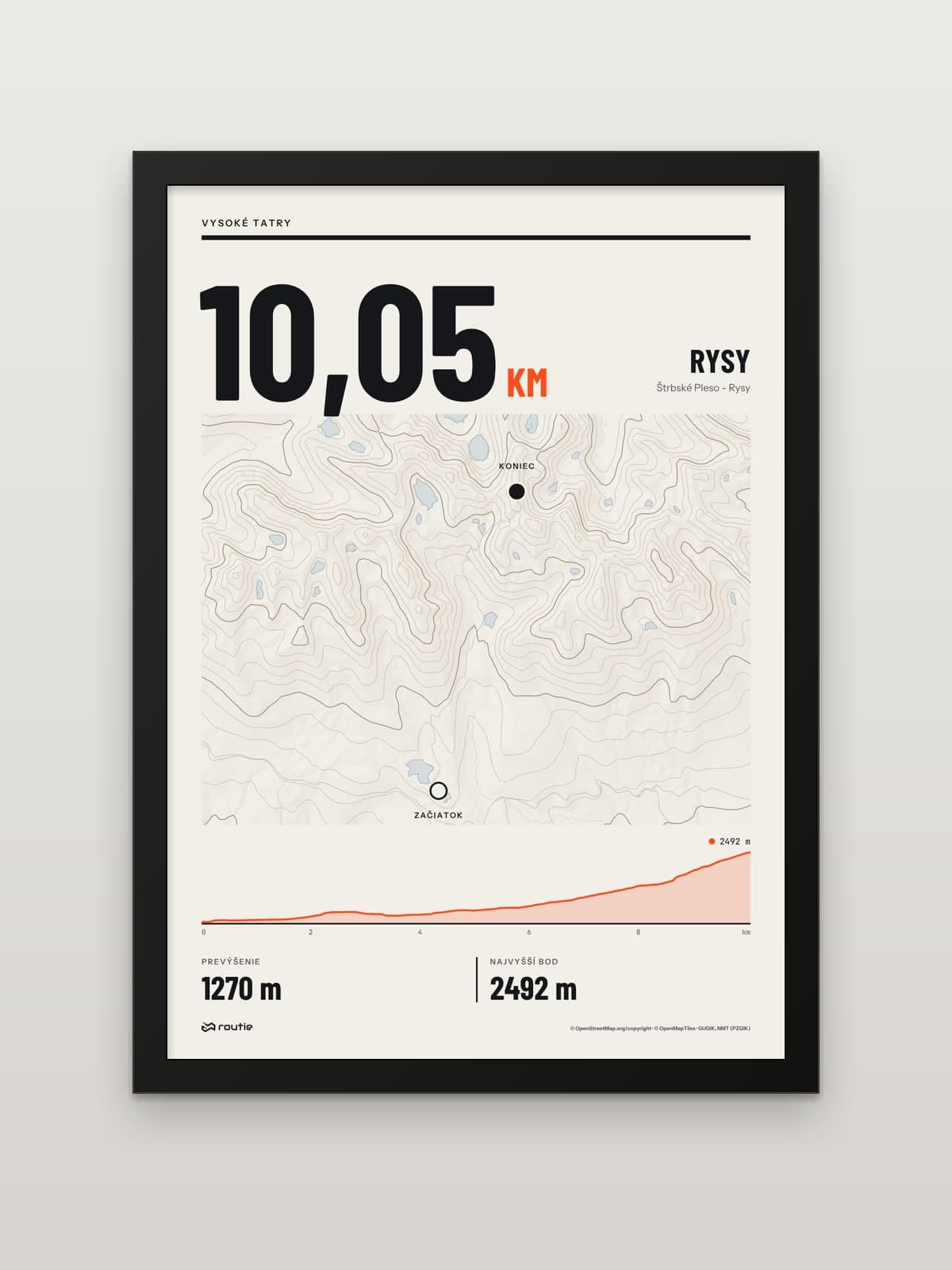
Climbed it another way, from Poland or with a detour? Upload your own recording instead: a GPX, TCX or KML file from your watch or app is all you need for a print of your own route.
Collecting high points? Two more summits we print:
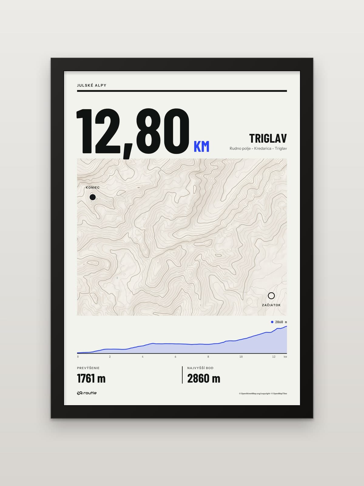
Triglav from Pokljuka: at 2,864 m, Slovenia’s highest peak, with Rudno polje among its starting points.
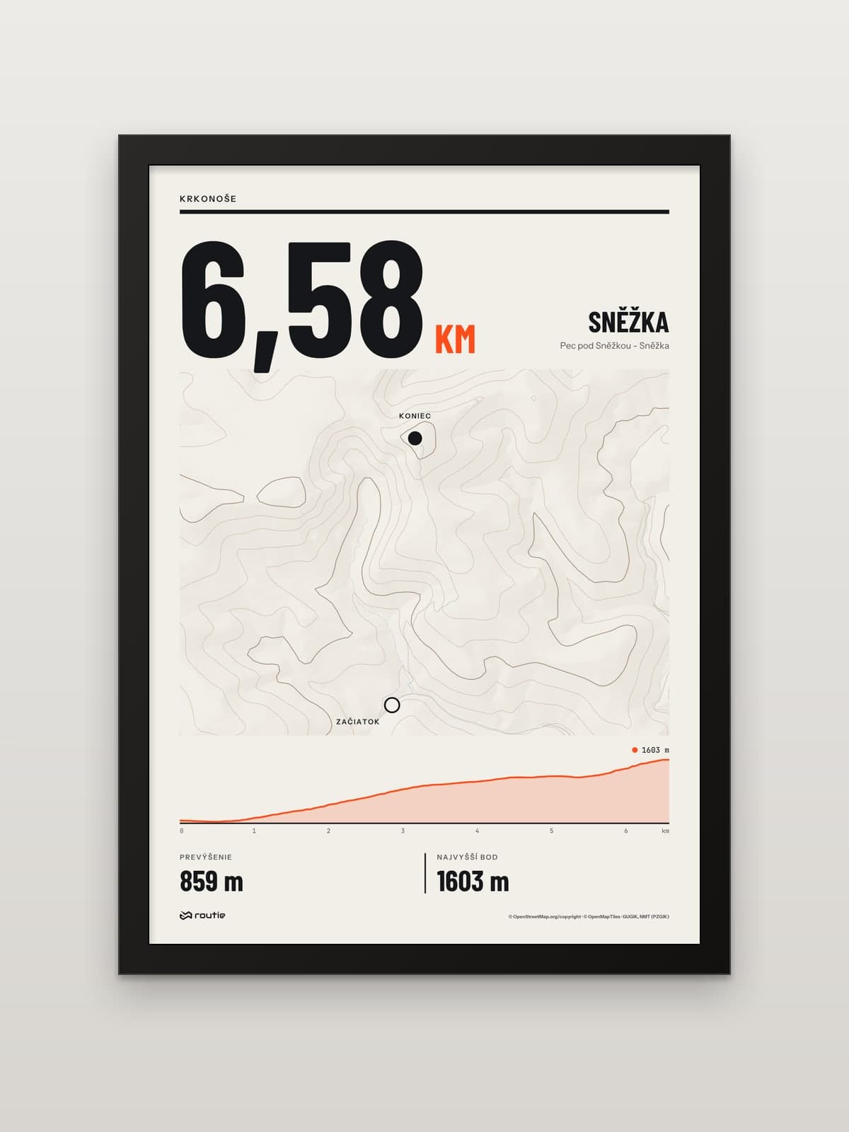
Sněžka from Pec pod Sněžkou: the highest mountain of the Krkonoše.
For a multi-day trip, read our guide to the Low Tatras ridge hike. And if you are looking for a present for someone who has already stood on Rysy, see our gifts for hikers.
Frequently asked questions
How long does the Rysy hike take?
About 4½ hours from Štrbské Pleso to the summit and 8½ hours for the full loop back via Popradské pleso. The official timings are 1¾ hours to the junction above Žabí potok, 1¾ hours to Chata pod Rysmi, a quarter of an hour to the Váha saddle and three quarters of an hour to the top.
How difficult is the Rysy hike?
It is a demanding high-mountain hike with 1,250 m of ascent and a long day. The hardest section is the rock step below Chata pod Rysmi, secured with fixed chains and used in both directions.
Should I hike Rysy from Slovakia or Poland?
For most hikers, from Slovakia. It has a hut on the way and chains only on one section. The Polish section from the Morskie Oko hut is shorter and steeper, with chains and a helmet that the official Zakopane trail page lists as obligatory.
What is the elevation gain on the Rysy hike?
From Štrbské Pleso, 1,250 m according to the official route description; our line from the station to the summit has 1,269 m of climb over 10.05 km. From the Morskie Oko hut on the Polish side it is 1,222 m over 4.7 km.
Can you hike Rysy in winter?
Not from Slovakia. The red trail from the junction above Žabí potok to the summit is closed from 1 November to 31 May.